Scroll To Top
Scroll To Top

Jerusalem — Old City Gates & Walls Photo Gallery

Click the title to view map

For Lions Gate, see Jerusalem — Via Dolorosa. For Zion Gate, see Jerusalem — Mount Zion. For Dung Gate and The Western Wall, see Jerusalem — Temple Mount.


Jerusalem Overview

Introduction

The walls surrounding Jerusalem’s Old City are among its most recognizable landmarks, but they are much younger than many of the places they enclose. Although Jerusalem has been fortified repeatedly since ancient times, the walls visible today date primarily to the Ottoman period.

They were built by order of Sultan Suleiman the Magnificent, ruler of the Ottoman Empire, during the sixteenth century. Construction took place mainly between 1537 and 1541, incorporating or following portions of earlier fortifications. Nearly five centuries later, these massive limestone walls, towers, battlements, and gateways still define the boundaries of the Old City.

The gates were more than openings through the defenses. They connected Jerusalem with the roads leading to surrounding towns and regions and became important points of movement for residents, merchants, pilgrims, and travelers. Most of the familiar gates—including Jaffa Gate, Damascus Gate, Zion Gate, Dung Gate, Lions Gate, and Herod’s Gate—belong to Suleiman’s rebuilding program. New Gate, however, was opened much later, in the Ottoman period in 1889, while the Golden Gate in the eastern wall remains sealed.

This gallery explores Jerusalem’s walls and gates as they appear today, while also considering the centuries of history preserved in and around them. The walls may be Ottoman, but they stand along a landscape that has been fortified, destroyed, rebuilt, and reshaped many times throughout Jerusalem’s long history.

Slide Presentation Major Events

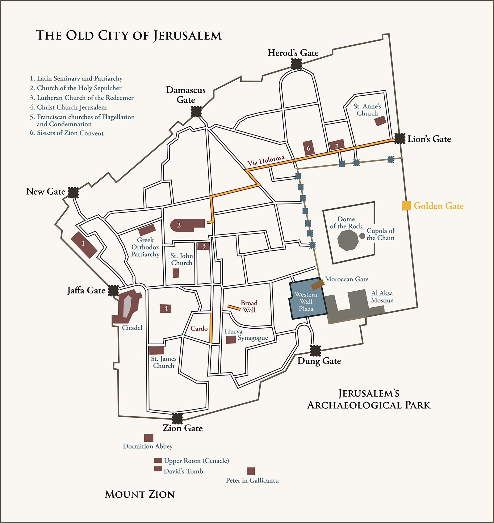
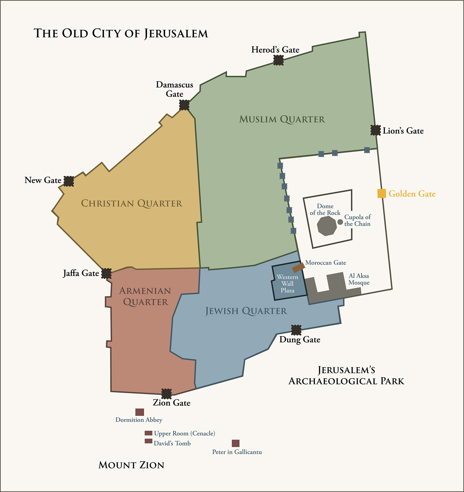
Click the map to show or hide the quarters of the Old City

Map

Major Events at Jerusalem

Jerusalem - Golden Gate

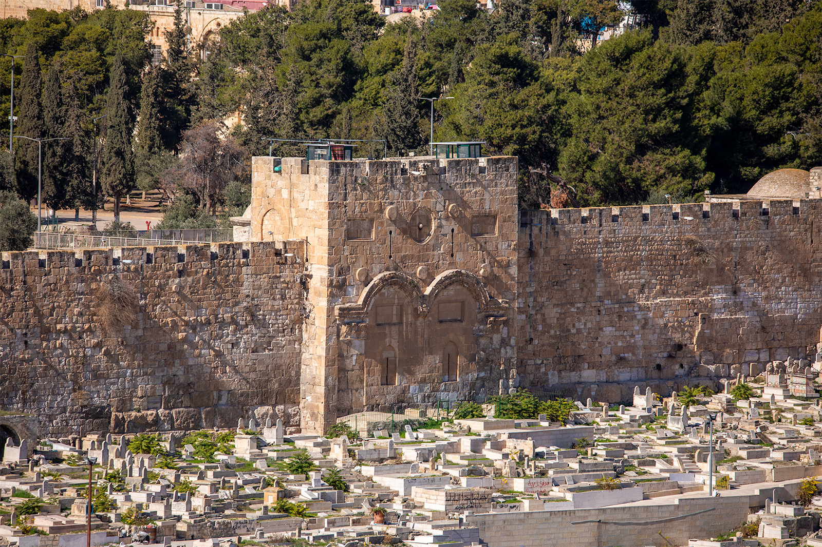
The Golden Gate, set into the eastern wall of the Old City, faces the Mount of Olives across the Kidron Valley. Its two arched entrances have been sealed for centuries. The present structure probably dates to the Byzantine or early Islamic period, making it considerably older than the surrounding sixteenth-century Ottoman walls.

The gate has particular religious significance. Jewish tradition associates this area with the future coming of the Messiah, while Christian tradition has long connected the gate with Jesus’s triumphal entry into Jerusalem. Its Arabic names, Bab al-Rahma (“Gate of Mercy”) and Bab al-Tawba (“Gate of Repentance”), also reflect its importance in Islamic tradition.

Jerusalem - Herod's Gate

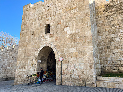
Herod’s Gate opens through the northern wall of the Old City into the Muslim Quarter. The present gate was constructed as part of Suleiman the Magnificent’s sixteenth-century rebuilding of Jerusalem’s walls. Originally a smaller entrance, it was enlarged during the Ottoman period to provide easier access through the wall.

The English name comes from a later Christian tradition that mistakenly located the palace of Herod Antipas nearby. Its Arabic name, Bab al-Zahra, is commonly translated as the “Flower Gate,” a name sometimes associated with the decorative stone rosette visible above the entrance.

Jerusalem - New Gate

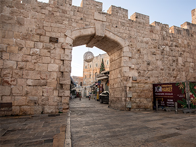
Unlike most of Jerusalem’s Old City gates, the New Gate was not part of Suleiman the Magnificent’s original sixteenth-century fortifications. It was opened through the northwestern wall in 1889, during the reign of Ottoman Sultan Abdülhamid II, making it the newest of the Old City’s principal gates.

The new opening provided more direct access between the Christian Quarter and neighborhoods developing outside the walls, particularly institutions northwest of the Old City. Its comparatively simple design and direct passage through the wall distinguish it from the more elaborate, defensively designed gates of earlier periods.

Damascus Gate

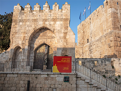
Damascus Gate is the most imposing of the entrances through Jerusalem’s Old City walls. The present gate was constructed in 1537–1538 during the reign of the Ottoman sultan Suleiman the Magnificent, as part of the rebuilding of Jerusalem’s fortifications. Its elaborate battlements, towers, and deeply recessed entrance distinguish it from the other gates of the city.

The English name reflects the road that traditionally led north from Jerusalem toward Shechem (Nablus) and ultimately Damascus. In Arabic the gate is called Bab al-Amud, the “Gate of the Column,” preserving the memory of a Roman column that once stood inside the ancient gateway.

Damascus Gate

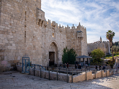
Seen from the northeast, Damascus Gate reveals how strongly it was designed for defense. The entrance is protected by projecting towers and an indirect approach rather than a simple opening through the wall. Visitors entering the Old City descend through the gate before emerging into the busy streets of the Muslim Quarter.

The gate has long been one of Jerusalem’s principal northern entrances. Beneath and beside the Ottoman structure are remains of earlier fortifications, demonstrating that this location served as an important entrance to the city centuries before the present walls were built.

Damascus Gate

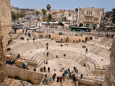
Viewed from the Old City wall, the broad stepped plaza spreads out before Damascus Gate. The modern landscaping follows the considerable difference in elevation between the gate and the streets of East Jerusalem immediately outside the walls.

This remains one of the busiest gathering places around the Old City. Pedestrians arriving from northern and eastern Jerusalem converge here before passing through Damascus Gate into the Muslim Quarter, continuing a pattern of movement associated with this entrance for many centuries.

Damascus Gate

Below and just east of the present Damascus Gate are remains of an earlier Roman gateway, constructed after Jerusalem became the Roman city of Aelia Capitolina in the second century AD. The surviving smaller arch originally formed part of a monumental three-arched entrance, with a much larger central opening flanked by two smaller passages.

From this Roman gateway a major street extended southward into the city. The Arabic name Bab al-Amud—“Gate of the Column”—recalls a large column that stood in the plaza inside the Roman gate and appears on the sixth-century Madaba Map. These remains provide a striking glimpse of Jerusalem’s street level more than a thousand years before the present Ottoman gate was constructed.

Damascus Gate

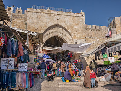
Immediately inside Damascus Gate, the entrance opens onto one of the Old City’s busiest commercial areas. Shops and stalls crowd the narrow streets, selling clothing, food, household goods, souvenirs, and other merchandise to residents and visitors.

The principal streets descending from this area follow routes with remarkably ancient origins. In Roman and Byzantine Jerusalem, major thoroughfares extended southward from the northern gate, including the Cardo, the city's principal north-south street.

Damascus Gate

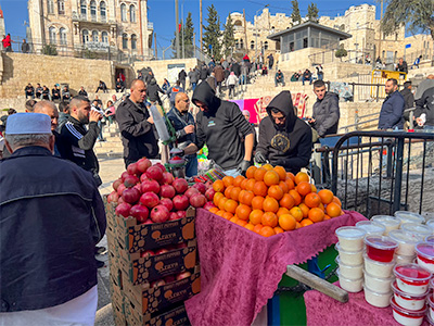
Commerce extends beyond the walls as vendors set up stalls around the plaza outside Damascus Gate. Fresh fruit, vegetables, prepared foods, clothing, and other goods make the area as much a neighborhood marketplace as an entrance for tourists and pilgrims.

The scene reflects one of the enduring functions of a major city gate. Gates were not simply defensive openings in a wall; the movement of travelers and goods naturally made the areas around them centers of transportation, commerce, and public activity.

Garden Tomb

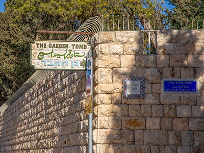
The entrance to the Garden Tomb lies just north of Jerusalem’s Damascus Gate, reached by a short lane named for Conrad Schick (1822–1901), a German architect, missionary, and pioneering investigator of Jerusalem’s archaeology. Schick lived in Jerusalem for more than fifty years, studying the city’s ancient remains and publishing extensively for the Palestine Exploration Fund. Among his many contributions, he investigated Jerusalem’s water systems and the Siloam Inscription and was the first scholar to publish a description of the Garden Tomb.

The lane leading from Nablus Road to the Garden Tomb was named Conrad Schick Street in recognition of his contributions to Jerusalem and his association with the site. Schick examined the newly discovered tomb in the nineteenth century and published a description of it in 1874—years before General Charles Gordon popularized the site as a possible location of Jesus’s burial.

Garden Tomb

Set within a quiet garden north of Jerusalem’s Old City stands the rock-cut tomb that gives the Garden Tomb its name. The tomb was uncovered in the nineteenth century and later became closely associated with General Charles Gordon, who in 1883 promoted the nearby skull-shaped escarpment as a possible location of Golgotha. The Garden Tomb Association acquired the property in 1894 and has preserved it as a place of Christian worship and reflection ever since.

The setting is especially evocative of John’s account, which states that near the place where Jesus was crucified “there was a garden; and in the garden a new sepulchre” (John 19:41). Although the identification of this particular tomb with Jesus remains disputed by some, the combination of a garden, an ancient tomb, and nearby Skull Hill makes the site a powerful setting in which to contemplate the Crucifixion and Resurrection.

Garden Tomb

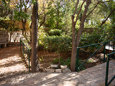
The landscaped grounds surrounding the tomb help preserve the character that gave the Garden Tomb its modern name. Paths wind through trees, shrubs, and quiet gathering areas, creating a striking contrast with the busy streets of Jerusalem immediately outside the walls.

Since the property was acquired by the Garden Tomb Association in 1894, the approximately two-acre site has been maintained as a place where visitors from many Christian traditions can gather, worship, and reflect on the final events of Jesus’ mortal ministry. The peaceful garden setting has become an important part of the experience, regardless of conclusions about the tomb’s historical identification.

Garden Tomb

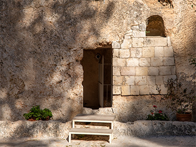
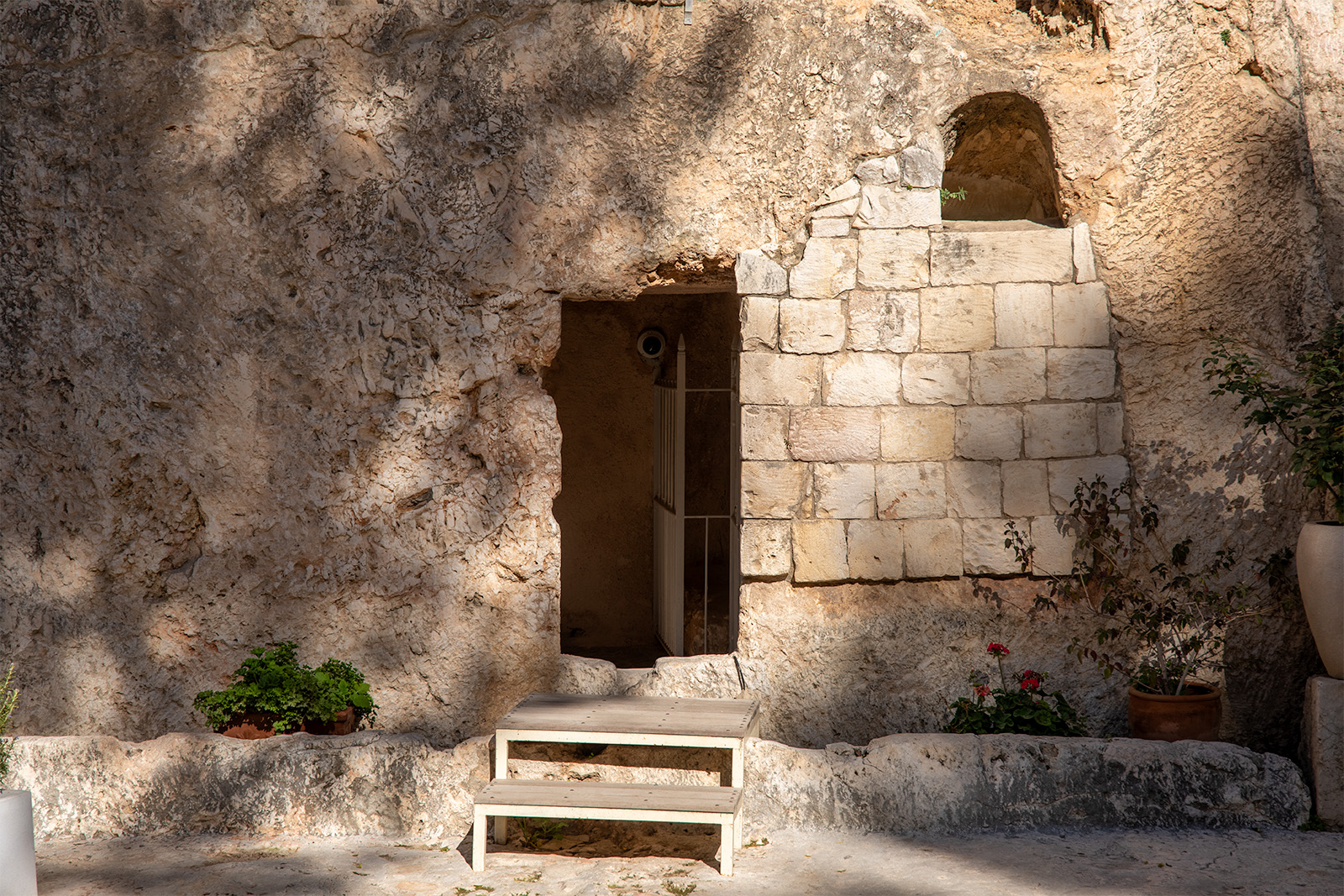
The entrance to the Garden Tomb is cut into the limestone cliff, with the burial chambers lying beyond the doorway. The entrance has been altered over the centuries; portions were damaged and later repaired with stone blocks. A rock-cut channel in front of the tomb has traditionally been associated with a rolling stone, although it too was extensively modified in later periods.

The tomb’s date remains important to discussions of the site. While it was once promoted as a possible first-century tomb, archaeological studies have argued that its original cutting belongs much earlier, probably to the Iron Age, in the eighth or seventh century BC, with later reuse. For this reason, many archaeologists do not identify it as the actual tomb of Jesus. Nevertheless, its form and setting provide visitors with a vivid setting for considering the Gospel accounts of Christ’s burial and Resurrection.

Garden Tomb

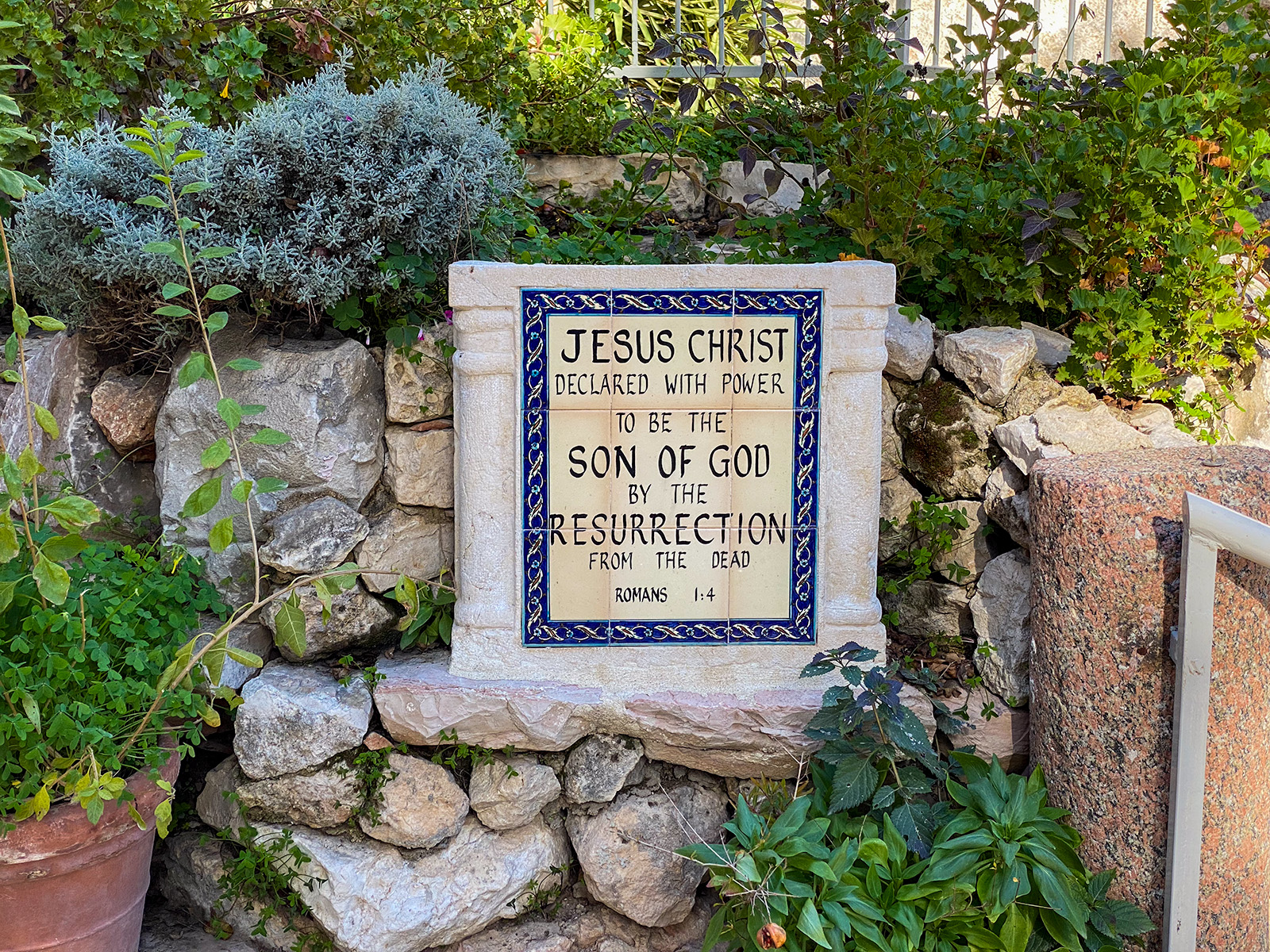
Among the gardens surrounding the tomb are reminders of the central message celebrated at this site. This plaque bears words adapted from Romans 1:4, proclaiming Jesus Christ as the Son of God through the power of the Resurrection.

The Garden Tomb is intentionally maintained not simply as an archaeological attraction but as a place of Christian worship and witness. Its caretakers acknowledge that the precise location of Jesus’s tomb cannot be established with certainty and emphasize instead the event commemorated here—the death, burial, and Resurrection of Jesus Christ.

Garden Tomb

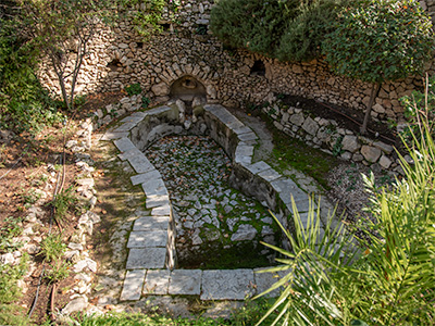
An ancient winepress cut into the rock is one of several archaeological features preserved within the Garden Tomb grounds. Grapes would have been crushed in the upper portion of the installation, with the juice collected for processing into wine. Its presence indicates that the property was used for agricultural purposes at some period in antiquity.

The winepress is particularly interesting because the Gospel of John places Jesus’ burial in a garden near the place of Crucifixion (John 19:41). The winepress therefore contributes to the site’s garden-like historical setting, although its precise date is uncertain and archaeology cannot establish that this was the garden described in the Gospel.

Garden Tomb

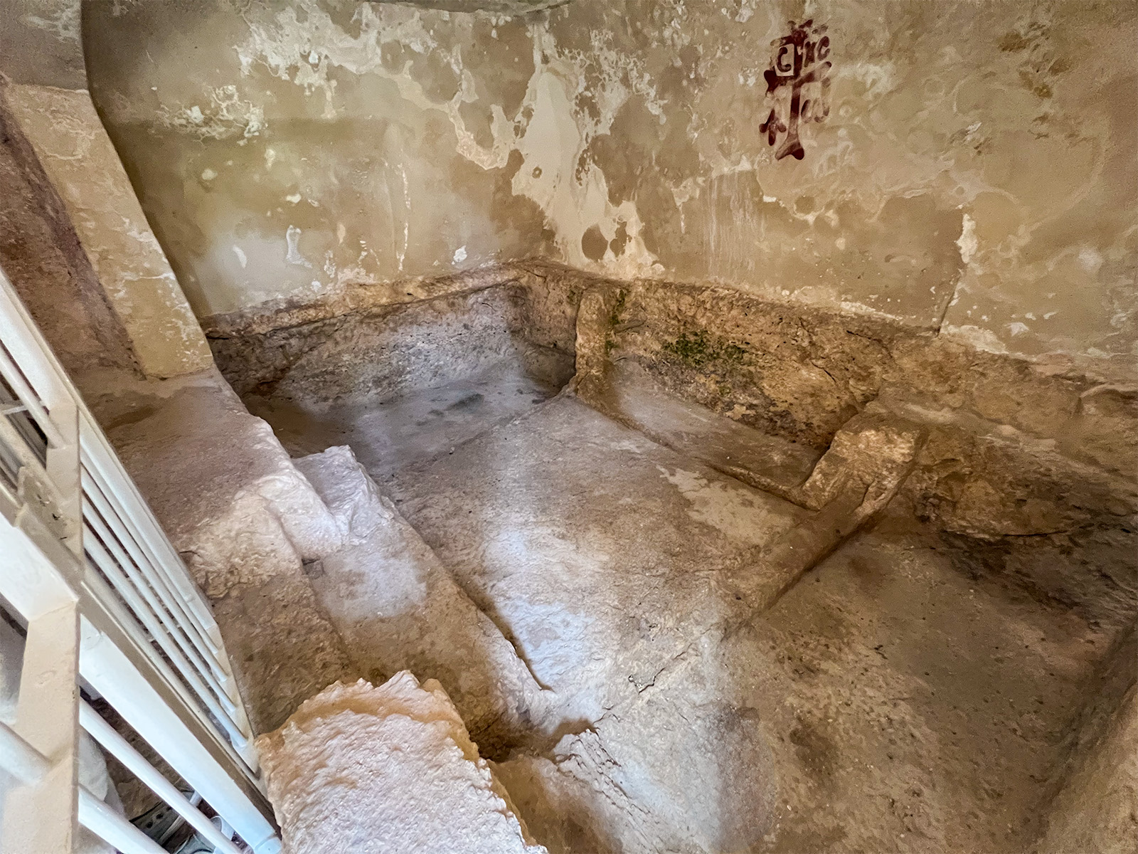
Inside the Garden Tomb, the surviving contours of the rock reveal where ancient burial benches once extended along the walls. In the tomb’s original form, a body would have been laid lengthwise on one of these raised stone benches, rather than placed in the recessed area seen today. The benches were more than six feet long and approximately waist high, providing sufficient space for the deceased to be laid out full length.

The body would have been wrapped in burial cloths and placed on its back, with the head at one end of the bench and the feet at the other. The precise orientation of a burial on the bench pictured here cannot now be determined. This arrangement nevertheless helps visualize John’s description of Mary Magdalene seeing two angels “sitting, the one at the head, and the other at the feet, where the body of Jesus had lain” (John 20:12). The original benches of the Garden Tomb were later cut down and altered, probably during the Byzantine period, leaving the irregular rock surfaces visible today.

The red symbol on the rear wall reproduces a Byzantine Christian cross discovered within the tomb. The original, now protected beneath plaster, was accompanied by the Greek abbreviations IC XC (“Jesus Christ”) and Alpha and Omega, identifying Christ as “the beginning and the end.” The markings probably date to the fifth or sixth century AD and testify to Christian use of the tomb during the Byzantine period.

Golgtha - The Garden Tomb

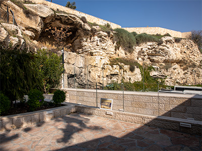
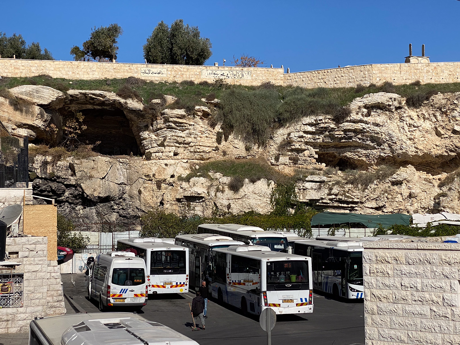
This rocky escarpment rises beside the Garden Tomb, just north of Jerusalem’s Damascus Gate. The cave visible near the upper left is associated with the area traditionally known as Jeremiah’s Grotto. According to a later tradition, the prophet Jeremiah withdrew to a cave here and composed his Lamentations while looking toward Jerusalem following the city’s destruction by the Babylonians in 586 BC. There is no historical evidence linking the cave with Jeremiah, but the tradition has been associated with this location for centuries.

The escarpment is also known as Skull Hill or Gordon’s Calvary. During the nineteenth century, some visitors believed that cavities and contours in the cliff resembled the eye sockets and features of a human skull. Since Golgotha means “Place of a Skull,” this resemblance helped lead General Charles Gordon and others to identify the hill as a possible location of Jesus’ Crucifixion. The nearby Garden Tomb consequently became associated with the Gospel accounts of Christ’s burial and Resurrection.

Golgatha - Garden Tomb

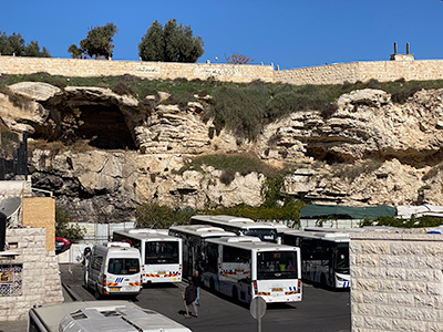
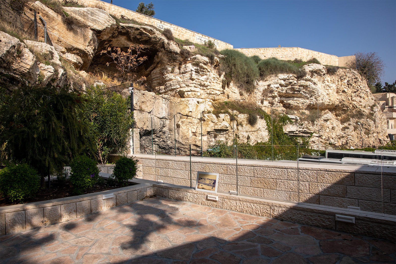
This wider view shows the rocky escarpment seen in the previous photograph and its relationship to the Garden Tomb, located just to the north. The cliff is traditionally known as Skull Hill or Gordon’s Calvary. Its weathered cavities once gave the rock face a more pronounced skull-like appearance, helping lead nineteenth-century visitors to associate it with Golgotha, the “Place of a Skull.” The large cave at the upper left lies in the area traditionally associated with Jeremiah’s Grotto.

The modern setting is clearly visible here. A Muslim cemetery occupies the summit of the hill, behind the stone wall, while the East Jerusalem Arab bus station fills the former quarry at its base. Visitors standing at the Garden Tomb overlook view Skull Hill across this bus station. The juxtaposition helps explain the geography of the Garden Tomb proposal: the suggested place of Crucifixion and the nearby rock-cut tomb lie outside the Old City walls, north of Damascus Gate and close to the ancient road leading north from Jerusalem.

Jaffa Gate

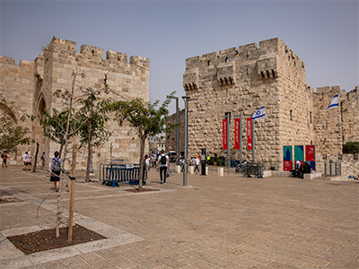
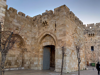
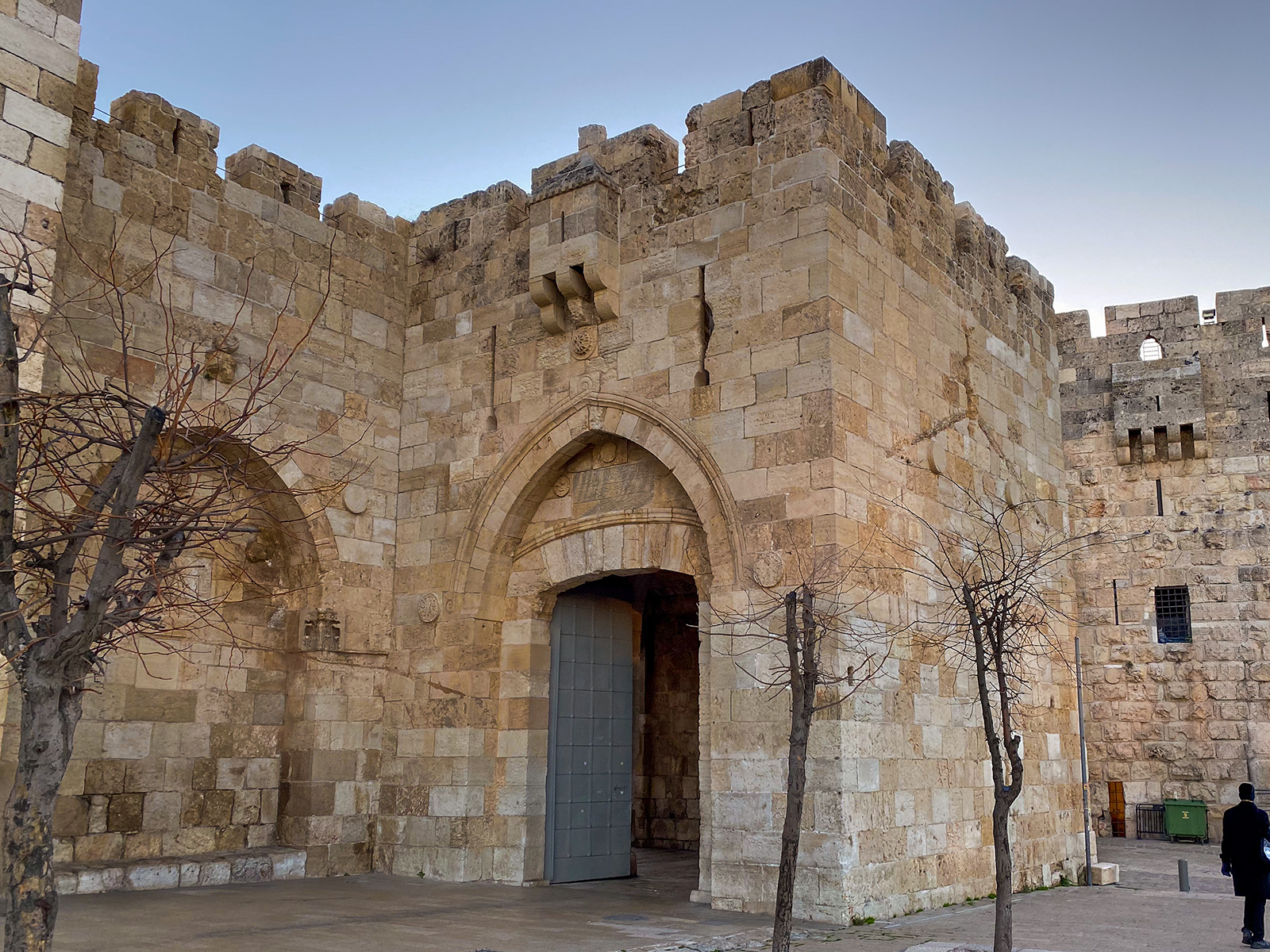
This is the original Jaffa Gate, built as part of Jerusalem’s Ottoman walls under Sultan Suleiman the Magnificent in 1538. Today this historic gateway is primarily used by pedestrians. Its passage makes a sharp turn after entering—a defensive design that prevented attackers from charging straight through the gate into the city.

Vehicles enter the Old City through a much wider opening immediately beside the historic gate, between Jaffa Gate and the Citadel. That opening was created by the Ottoman authorities in 1898, when part of the wall was removed and the adjoining moat filled so that German emperor Kaiser Wilhelm II and his entourage could enter Jerusalem by carriage. The opening was retained afterward and became the roadway used by vehicles entering and leaving the Old City today.

Jaffa Gate

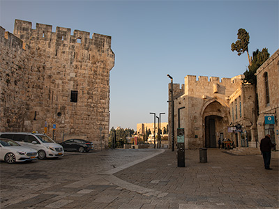
Viewed from inside Jerusalem’s Old City, Jaffa Gate opens westward toward modern Jerusalem. The large opening at center was created in 1898, when part of the wall and moat were altered to provide carriage access for the visit of German Kaiser Wilhelm II. Beyond the gate, the King David Hotel can be seen in the distance, linking the historic entrance to the modern city that developed west of the Old City walls.

To the right of the broad roadway is the original pedestrian entrance through Jaffa Gate, the arched passage seen from outside in the previous photograph. Like many Ottoman gates, its passage turns rather than running directly through the wall, a defensive design intended to make an enemy assault more difficult. The massive structure on the left is part of the Citadel, traditionally known as the Tower of David.

Jaffa Gate

Just inside Jaffa Gate, behind an iron railing, are two Ottoman-period tombs traditionally known as the Tombs of the Architects. According to a popular Jerusalem legend, they belong to the two architects responsible for constructing the Old City walls for Sultan Suleiman the Magnificent in the sixteenth century. The story relates that Suleiman had them executed because their fortifications left Mount Zion and the traditional Tomb of David outside the city walls. Other versions of the legend give different reasons for their deaths, and the identification of the tombs with Suleiman’s architects is traditional rather than historically certain.

At the left is the entrance to the Ramparts Walk, with signs directing visitors to the ticket and entrance area. Jaffa Gate serves as the starting point for both sections of the walk: one follows the northern ramparts toward Lions Gate, while the other follows the southern ramparts toward Dung Gate.

Jaffa Gate - Tower of David Museum

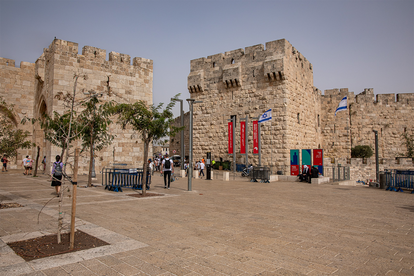
Jaffa Gate stands beside the massive Citadel, one of the most prominent landmarks along Jerusalem’s western Old City wall. The gate was constructed as part of Sultan Suleiman the Magnificent’s sixteenth-century rebuilding of Jerusalem’s fortifications and takes its name from the road that led westward toward the Mediterranean port of Jaffa.

The adjoining Citadel incorporates remains from several periods of Jerusalem’s history, although much of its present appearance dates to the Mamluk and Ottoman periods. Today it houses the Tower of David Museum of the History of Jerusalem, which uses the ancient fortress, its archaeological remains, and its towers to tell the story of the city across thousands of years.

Jaffa Gate

Just inside Jaffa Gate, the broad entrance plaza is one of the busiest gathering points in Jerusalem’s Old City. Visitors arriving through the gate encounter shops, restaurants, vendors, tour groups, and local residents before the narrow streets branch toward the Christian, Armenian, and Jewish Quarters.

The activity seen here reflects Jaffa Gate’s long-standing role as one of Jerusalem’s principal entrances. For centuries, travelers approaching from the west entered the city here, and today the area remains an important crossroads where the historic Old City meets the constant movement of modern Jerusalem.

Jerusalem - Old City Streets

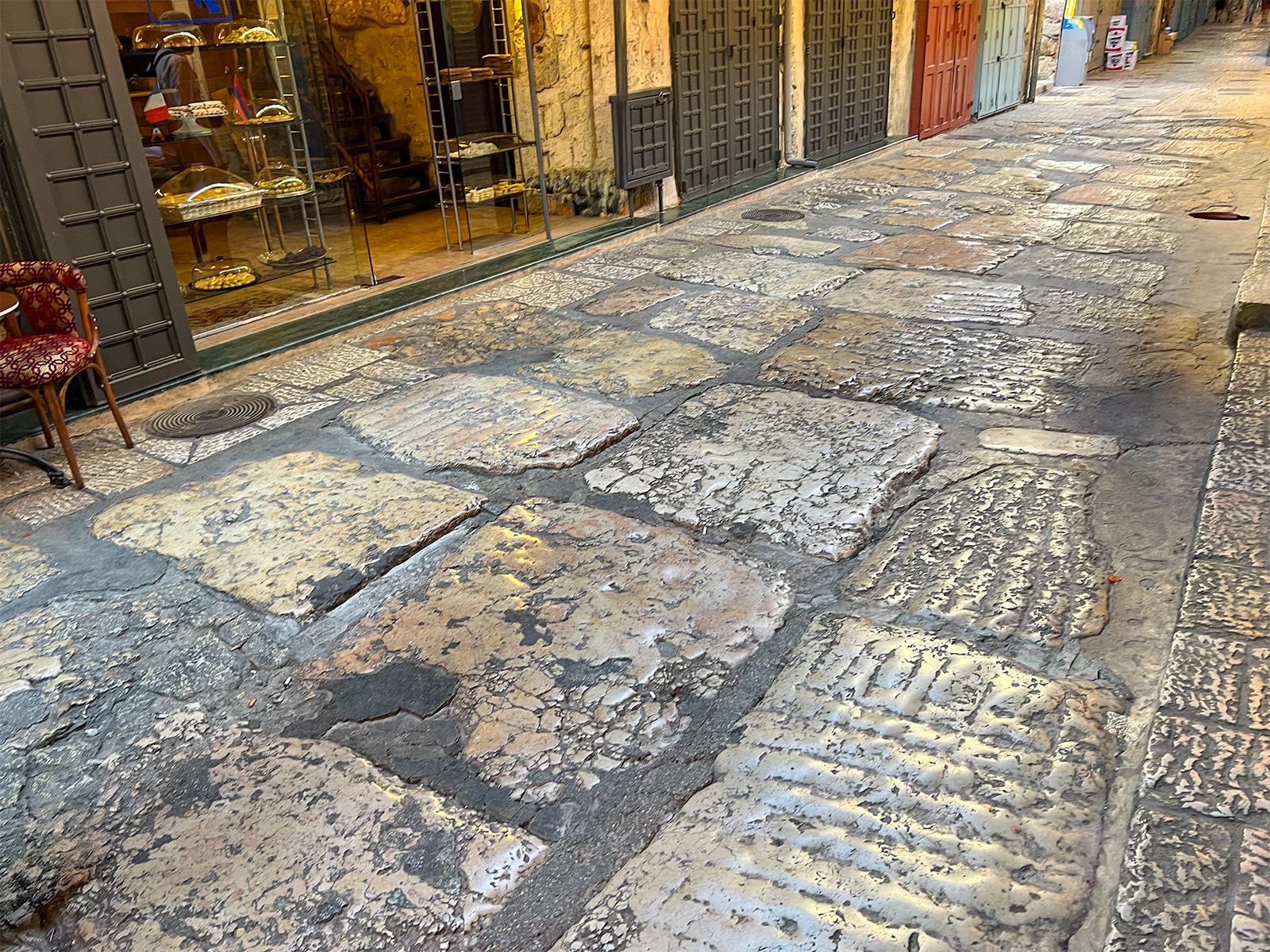
As you descend from Jaffa Gate into the Old City, it is easy to focus on the shops, crowds, and buildings and overlook what lies beneath your feet. The broad limestone paving stones have been worn smooth by generations of pedestrians, their polished surfaces reflecting the constant passage of people through Jerusalem’s narrow streets.

The paving visible today should not be mistaken for a street surface surviving unchanged from biblical times; Jerusalem’s streets have been repaired, rebuilt, and repaved repeatedly through the centuries. Yet the worn stones offer a tangible reminder of the antiquity of the city. As you walk through the Old City, occasionally look down—the streets themselves help convey the sense of countless generations who have walked these routes before you.

Tower of David Jerusalem Museum

This photograph, taken in January 2023, shows the historic eastern gateway of the Tower of David Museum, immediately inside Jerusalem’s Old City. At the time, this gateway served as the museum’s principal entrance and exit, as indicated by the red sign beside the doorway.

Six months later, in June 2023, the museum reopened following an extensive three-year renovation. A new sunken entrance pavilion was created near Jaffa Gate and Mamilla Avenue, changing the direction in which visitors move through the museum. Today visitors enter from the Jaffa Gate side, pass through the galleries and Citadel, and eventually exit into the Old City through the historic gateway shown here. Thus, this photograph preserves the former entrance arrangement shortly before the museum’s new visitor route opened.

Tower of David Jerusalem Museum

The Tower of David Citadel was not built at one time or by a single ruler. Its strategic position beside what is now Jaffa Gate has been fortified since antiquity. The Hasmoneans constructed walls and towers here in the second century BC, and Herod the Great later strengthened the site with three massive towers—Hippicus, Phasael, and Mariamne—to defend Jerusalem and his nearby royal palace. The surviving base of one of these towers remains incorporated into the Citadel today.

The fortress seen today developed through many later periods. An enclosed citadel was established during the early Muslim period; the Crusaders enlarged it to approximately its present dimensions and surrounded it with a moat; and the Mamluks, beginning in the thirteenth century, extensively rebuilt and strengthened the complex as a military stronghold guarding the western approach to Jerusalem. The Ottomans later renovated the Citadel and added its monumental gateway, cannon plaza, mosque, and familiar minaret. The result is not the work of a single age, but a fortress whose walls preserve successive layers of Jerusalem’s history.

Jaffa Gate - Tower of David Jerusalem Museum

Seen from inside Jaffa Gate, the massive structure on the right is Phasael Tower, the largest of three defensive towers built here by Herod the Great in the first century BC. Herod named it for his brother Phasael. Although the upper portions were rebuilt in later periods, the massive stone courses at its base preserve part of the Herodian tower. Today, visitors can climb to an observation point at the top for panoramic views across Jerusalem.

At the base of the Citadel, the recessed area and platform (left) above the railing are associated with the museum entrance-and-exit area discussed in the first photograph. Following the museum’s 2023 renovation, visitors now enter through the new pavilion near Jaffa Gate, proceed upward through the Citadel and Phasael Tower, and exit into the Old City through the historic eastern gateway.

Jaffa Gate - Tower of David Jerusalem Museum

Looking down from the upper walls of the Tower of David Citadel, this view shows the close relationship between the fortress and Jaffa Gate, Jerusalem’s principal western entrance. The photograph looks westward from the Old City toward modern Jerusalem, with the Citadel’s walls and courtyards filling the foreground and the newer city spreading across the horizon.

Near the upper center-right is Jaffa Gate and its entrance plaza. From the gate, David Street descends into the Old City along the right side of the photograph, beginning the busy network of narrow streets and shops encountered immediately after entering the city. The elevated viewpoint is part of the Citadel complex near Phasael Tower, whose observation point provides sweeping views in every direction—across both the Old City and modern Jerusalem beyond its walls.

Tower of David Jerusalem Museum

This panoramic view across Jerusalem’s Old City brings together two of its most prominent Christian landmarks. At left, the large gray domes mark the Church of the Holy Sepulchre, built over the traditional sites of Jesus Christ’s crucifixion, burial, and resurrection. At right, the tall bell tower of the Lutheran Church of the Redeemer, completed in 1898, rises prominently above the surrounding buildings of the Christian Quarter.

Beyond the Old City, Mount Scopus forms the high ridge across the background. The buildings along its crest belong largely to the Hebrew University of Jerusalem’s Mount Scopus campus. Near the center of the ridge, the prominent tower is part of the university complex and is a conspicuous Jerusalem landmark, visible from a considerable distance—including from the east as travelers approach Jerusalem from Jericho and the Jordan Valley.

View from the Tower of David Jerusalem Museum

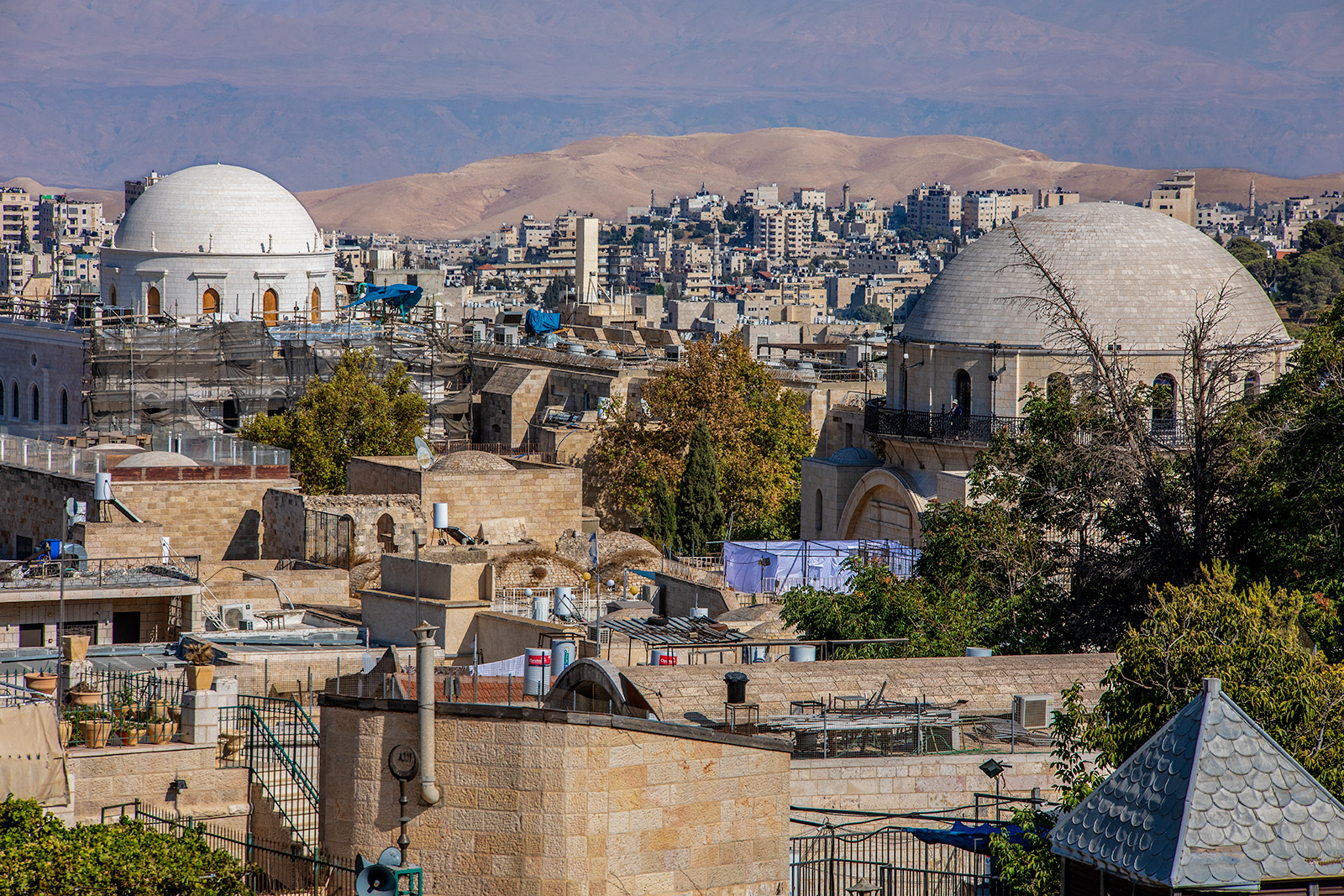
Looking east from Jerusalem’s Old City, the domes of two of the Jewish Quarter’s most prominent synagogues rise above the surrounding rooftops. At right is the Hurva Synagogue, rebuilt and rededicated in 2010 after the earlier structure was destroyed during the 1948 war. At left is the newly restored Tiferet Yisrael Synagogue, also known as the Nisan Bek Synagogue. Originally dedicated in 1872 and destroyed in 1948, its reconstruction has restored its distinctive white dome to the Old City skyline.

Beyond the Old City, modern Jerusalem gives way to the dry hills of the Judean Wilderness, which descend eastward toward the Dead Sea and Jordan Valley. In the far distance, beyond the Jordan Valley, rise the mountains of the Jordanian plateau, emphasizing Jerusalem’s position near the western edge of the great rift that separates the Judean highlands from the mountains east of the Jordan.

Tower of David Jerusalem Museum
A detailed model of the Dome of the Rock stands at the center of the museum’s gallery devoted to Jerusalem in Islamic tradition. Built on the Temple Mount by the Umayyad caliph ʿAbd al-Malik in the late seventh century, the Dome of the Rock is one of Jerusalem’s most recognizable landmarks and one of the earliest surviving major monuments of Islamic architecture.

Throughout the museum, explanatory captions, models, archaeological objects, interactive displays, and multimedia presentations help visitors place familiar landmarks within the larger history of Jerusalem. Here the model allows the Dome of the Rock to be examined closely while the surrounding displays explain the beginning of Muslim rule in Jerusalem, the sacred importance of the Temple Mount/Haram al-Sharif in Islam, and the architectural and religious legacy that the Islamic periods added to the city.

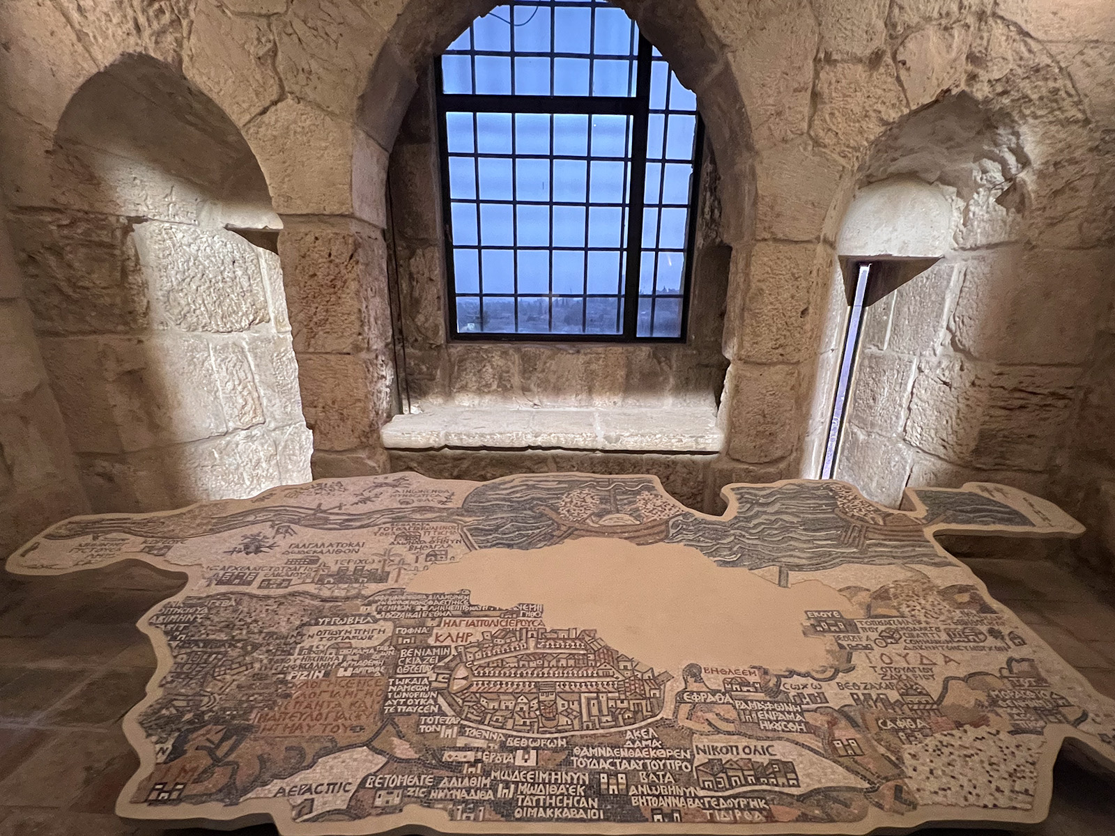
Medaba Map - Tower of David Jerusalem Museum

The Tower of David Jerusalem Museum uses archaeological remains, historical objects, maps, models, and modern interactive displays to help visitors trace Jerusalem’s long and complex history. Rather than focusing only on the Citadel itself, the museum places the fortress within the larger story of a city shaped over thousands of years by different peoples, empires, and religious traditions.

This reproduction of the Madaba Map illustrates how historical sources can help reconstruct that story. The original is a sixth-century Byzantine mosaic floor discovered in Madaba, Jordan, depicting the Holy Land with Jerusalem given exceptional prominence. Its detailed representation of Byzantine Jerusalem—including the walled city, gates, streets, and major Christian buildings—provides valuable evidence for understanding the appearance and organization of Jerusalem centuries before the modern city developed. Displaying the map here allows visitors to compare an ancient representation of Jerusalem with the city whose streets, walls, and monuments surround them today.

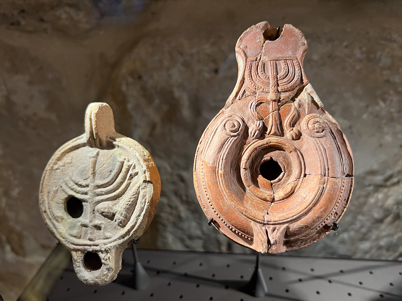
Tower of David Jerusalem Museum

Ancient clay oil lamps are among the many archaeological objects displayed throughout the Tower of David Jerusalem Museum. Small lamps such as these were commonplace in antiquity, providing light in homes and other buildings, while their shapes and decoration often reflect the artistic and religious traditions of the communities that used them. The menorah prominently depicted on these examples identifies them with Jewish life and memory.

Displays such as this complement the museum’s maps, models, films, and interactive presentations. Rather than telling Jerusalem’s history only through kings, conquests, and monumental buildings, the museum incorporates objects left by people who actually lived through its different periods. Together, these artifacts help turn Jerusalem’s long chronology into a more tangible human story.